
Loadmaster (David R. Tribble) This image was made by Loadmaster (David R. Tribble). Email the author: David R. Tribble. Also see my personal gallery at Google Photos, CC BY-SA 3.0, via Wikimedia Commons.
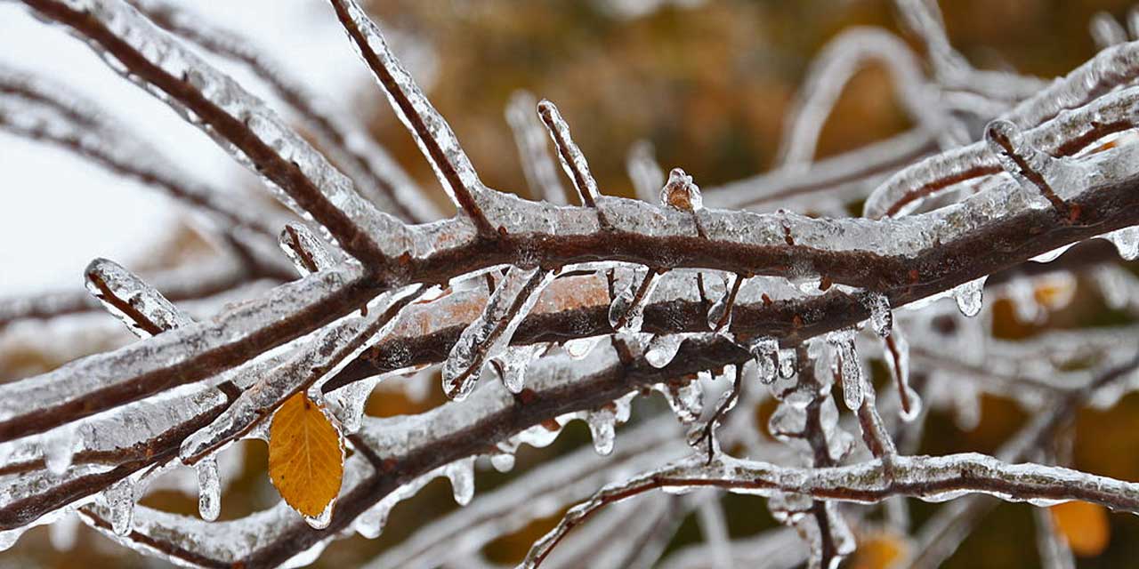
On this, the first day of winter, let’s reflect – do you remember the ice storms of 2012 or 2007? Trees (and everything!) were coated in ice, making them heavy and often knocking them down into power lines, disrupting the power grid, stopping traffic, travel and much more.
It was such a mess in 2012 that then-Gov. Christine Gregoire proclaimed a State of Emergency, and nearly 300,000 people were left without power. A man was killed in Issaquah from a falling tree, and Sea-Tac Airport had to shut down for a while due to layers of ice coating the runways.
And did we mention that trees and branches overloaded with layers of ice fell over and knocked down power lines?
Well, that scenario *could* happen again, as the chance of freezing rain is being predicted for our region starting Thursday night, Dec. 22, 2022. But luckily the temps will increase by Friday night, turning the incoming atmospheric river into just rain and maybe some wind.
“The airmass will undergo a fairly quick transition, which has increased the odds for freezing rain overnight into Friday morning,” NWS said in its forecast discussion. “Details on ice accumulation are limited at this time as the atmospheric set up for freezing rain can be difficult to assess at this juncture in the forecast.”
NWS warns:
“What is known about freezing rain is that it can be much more impactful than snow is because as it accumulates on surfaces such as power lines and trees, they feel the stress and weight of the ice and are prone to breaking. Additionally, it poses impacts to travel as the road surfaces become slippery very quickly as the layer of ice builds. It is very important to pay attention to forecast updates as it can and will change.”
Local @SeattleWXGuy Michael Snyder gives an excellent analysis of this possible system here:
Here’s the detailed 7-day forecast from the National Weather Service:
-
- Wednesday: Mostly sunny, with a high near 28. Wind chill values between 14 and 19. North wind 7 to 10 mph.
- Wednesday Night: Partly cloudy, with a low around 15. Wind chill values between 7 and 12. East northeast wind around 10 mph, with gusts as high as 22 mph.
- Thursday: A 30 percent chance of snow after 4pm. Cloudy, with a high near 23. Wind chill values between 5 and 13. Southeast wind around 10 mph, with gusts as high as 22 mph. Little or no snow accumulation expected.
- Thursday Night: Snow before 1am, then snow, possibly mixed with freezing rain. Low around 21. Wind chill values between 12 and 17. East southeast wind 7 to 9 mph, with gusts as high as 20 mph. Chance of precipitation is 80%. New snow accumulation of 1 to 2 inches possible.
- Friday: Snow, possibly mixed with freezing rain before 1pm, then rain. High near 39. South wind 6 to 8 mph. Chance of precipitation is 100%. New snow accumulation of less than a half inch possible.
- Friday Night: Rain. Low around 35. Chance of precipitation is 90%. New precipitation amounts between a quarter and half of an inch possible.
- Saturday: Rain. High near 49. Chance of precipitation is 100%.
- Saturday Night: Rain. Cloudy, with a low around 44.
- Christmas Day: Rain. Cloudy, with a high near 51.
- Sunday Night: Rain. Cloudy, with a low around 46.
- Monday: Rain. Cloudy, with a high near 52.
- Monday Night: Rain. Cloudy, with a low around 45.
- Tuesday: Rain. Cloudy, with a high near 50.
Join Snyder’s YouTube channel to help support the Pacific Northwest Weather Watch:
https://www.youtube.com/channel/UCSxR0IZEq1WhTJqAnQGyk4g/join
Winter Storm outlook (another!) for the Pacific NW! https://t.co/N149Ieco3L via @YouTube pic.twitter.com/R1N8CxJWfk
— Michael Snyder (@SeattleWXGuy) December 21, 2022
FZDZ coating everything in ice on top of slush and snow at SeaTac Airport, completely treacherous. #wawx pic.twitter.com/oALvOx0e34
— Michael Snyder (@SeattleWXGuy) December 21, 2022